Land Surveying Services

-
ALTA/NSPS Land Title Surveys
This is the most comprehensive type of survey and improvement location. It covers all aspects of the boundary survey and improvement location and identification of any additional evidence of possession or use that could be adverse to the interests of the purchaser. This type of survey is normally only performed on commercial property because of the expense involved. For a copy of the Minimum Standard Detail Requirements for ALTA/NSPS Land Title Surveys, you will need Adobe Acrobat Reader to download the Requirements. Current NSPS documents may be downloaded from NSPS.
-
Land Surveys
The Land Survey is generally a survey that is performed to identify the property boundaries. The surveyor will research and measure existing boundary positions based on found property pins or section cornerstones and monuments in the area and will establish new property corner pins for the client. Every property line has two owners, and the Land Survey allows both property owners to assert ownership of their boundaries.
-
Lot Surveys
Lot Surveys are a form of Land Survey in a platted subdivision. Property corners are set to identify boundary lines between neighbors. When constructing a structure such as a home, garage, or fence on a platted lot, most progressive communities require a Lot Survey to ensure all building setback requirements have been met, easements and rights-of-way have been identified, and that there are no encroachments either way across property lines.
-
Commercial Site Development Plans
Commercial sites are generally developed using a combination of several types of surveys, including boundary surveys, topographic surveys, land planning, design, and sometimes subdivision platting. The surveyor will identify existing characteristics of the project site and may be retained to plan for new infrastructure, grades, landscaping, and/or services for the proposed building project.
-
Land Planning and Design
Land Planning and Design are important components in the growth of a community. The extension of infrastructure such as water lines, sanitary sewer lines, streets, and storm sewers requires planning, design, and negotiations with public planners, engineers, and administrators. Many communities offer financing assistance through the sale of municipal bonds, allowing the infrastructure to be constructed and then paid for by special assessments over a period of twenty years. Garber Surveying Service, P.A. has worked with hundreds of developers to plan their subdivisions and has represented their clients through the planning and platting phases of their developments. Garber has a special interest in creating neighborhoods from raw land. Give Garber a call today and let their friendly staff walk you through the steps to create your own new neighborhood.
-
Subdivision Platting
The steps to Subdivision Development are as follows:
- Boundary Survey
- Topographic Survey
- Sketch Plan
- Obtain Title Report
- Meeting with Community Planners and Leaders
- Preliminary Plat
- Final Plat
- Engineering Drawings
- Subdivision Monumentation
- Petitions for Construction
- Construction Surveying
- Construction of Infrastructure
- Marketing of Building Sites
-
Topographical Surveys
This is a survey of real property with the main purpose of determining the configuration of the surface of the ground and the location of all-natural and artificial objects, including utilities, drainage ways, structures, ingress and egress to the property, and any other visible limitations or enhancements to the property. This survey should be performed in conjunction with a Boundary Survey to show lines of possession and is normally conducted for architectural planning or engineering design projects.
-
Construction Surveys
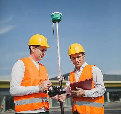
A survey was provided for a construction project to locate improvements to be made with information to control vertical and horizontal alignment and dimensions of the proposed improvements. Garber Surveying provides construction surveying services for many General Contractors in the Central Kansas region for highways, bridges, streets, sewers, waterlines, and pipelines.

-
Engineering Surveys
Business demands and technology are changing every day. The cost of maintaining survey professionals and instruments is increasing. Surveying rules and regulations are continually being revised or updated. Garber Surveying provides excellent service to the engineering industry by supplying professionals in the fields of surveying and drafting, which allows engineering professionals to concentrate on their areas of expertise. We will supply electronic field data or base sheet drafting, too. Ask Garber Surveying to provide a sample of their work and see your profit margin grow. You’ll enjoy the relationship that develops when you call Garber Surveying today.
-
GPS Surveys
A Global Positioning System is utilized to gather large amounts of horizontal and vertical data across relatively large areas. A local coordinate system or the State Plane Coordinate System can be used to generate coordinate geometry points and elevations in the project location. Satellites orbiting 12,000 miles above the earth’s surface provide radio signals, which are triangulated to compute the coordinates of the GPS instrument.
-
Mine Surveys
Underground mines, such as salt mines, require a network of underground survey lines to control the direction of the mining operation and to identify the location of mineral rights of various property owners.
-
Pipeline Surveys
Pipeline Surveys are utilized to plan the routing of major pipeline projects. Besides surveying the proposed route of a pipeline, the Land Surveyor will identify obstacles to construction and note property ownership for all tracts of land along the pipeline route.
-
Quantitative Surveys
A survey of material stockpiles for purposes of inventory control is called a Quantitative Survey. Quantitative Surveys are utilized to compute the quantity of material removed from a stockpile or borrow area.
-
CAD Drafting
Survey results are usually drafted with the use of CAD (Computer-Aided Drafting) Systems. Garber Surveying Service, P.A. provides CAD drafting for all boundary surveys, ALTA/NSPS Land Title Surveys, and subdivision plats.
-
Flood Zone Surveys
The Flood Zone Survey is performed for the purpose of rating the cost of flood insurance. It reports the relative vertical distance above or below a base flood elevation from a Flood Insurance Rate Map (FIRM). The FIRMs were produced by the Federal Emergency Management Agency of our federal government for use in the National Flood Insurance Program (NFIP). The FIRMs are made to give a quick idea of whether a property and building are in a special flood hazard area. The FIRM typically shows no buildings, and many minor or residential streets are not shown. So, the surveyor is often called upon to measure the elevation of a building and report on a Flood Zone Survey how far above or below the base flood elevation it is. If a residential or commercial structure is located above the Base Flood Elevation, Garber Surveying Service, P.A. will prepare applications for the Federal Emergency Management Agency to consider removing the existing structure from the 100-Year Flood Zone.
-
Forensic or Crash Site Surveys
A survey of a crash site will delineate all manner of information available at a crash site, such as locations of vehicles, obstacles, utilities, and other physical features for use in a court of law. The Land Surveyor is generally subpoenaed or requested to appear in court to represent the Forensic or Crash Site Survey.
-
Graphics Scanning and Plotting
Garber Surveying Service, P.A. will reproduce drawings for the client’s projects and can even scan and plot drawings of non-reproducible large-format documents.
-
Boundary and Improvement Surveys
A boundary survey of the subject property will be made, and the property corners will be located and verified or reset. The improvements on the property will be located, and a check for violations or encroachments onto or from the subject property will be made. This survey can be used by the property owner for the construction of a fence, structure, or other improvements.
-
Tract Surveys
A tract survey is similar to a boundary survey in that a boundary survey of the subject property will be made, and the property corners will be located and verified or reset. This survey is normally performed on large parcels of land, which have improvements that do not require location. A check for violations or encroachments onto or from the subject property will be made, with the primary emphasis being concentrated along the property lines in order to establish any conflicts between the surveyed line and any apparent lines of possession. This survey can be used by the property owner for the construction of a fence, structure, or other improvements.
-
Mortgage Title Inspections
The sole purpose of this inspection is to obtain mortgagee title insurance. This is the minimum service that your lender requires for closing your loan. It is a location of improvements and a cursory check for violations or encroachments onto or from the subject property based on existing but not confirmed evidence. This does not constitute a boundary survey and is subject to any inaccuracies that a subsequent boundary survey may disclose. No property corners will be set, and they should not be used or relied upon for the establishment of any fence, structure, or other improvement. No warranty of any kind is extended therein to the present or future owner or occupant.
For more on our land surveying services, call 620-665-7032.

